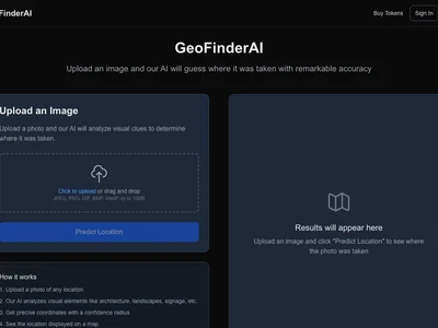
GeoFinderAI: Instantly identify location data from images and videos, saving time and resources on geolocation tasks.
Boost this tool
Subscribe to listing upgrades or segmented pushes.
GeoFinderAI is a powerful AI-driven tool designed to extract geographical location data embedded within images and videos. It analyzes visual cues, metadata, and other available information to pinpoint the exact location where a photo or video was taken, providing accurate and reliable geolocation results. The key benefit is significantly reducing the time and effort required for manual geolocation, which is often a time-consuming and complex process.
GeoFinderAI works by employing advanced computer vision algorithms and machine learning models. It analyzes image features like landmarks, vegetation, architectural styles, and even subtle details like road signs to estimate the location. It also parses metadata like GPS coordinates, timestamps, and camera information, cross-referencing this data with vast geographical databases. Key features include support for various image and video formats, batch processing capabilities, and a user-friendly interface for easy data interpretation.
GeoFinderAI is ideal for law enforcement agencies, journalists, researchers, and intelligence analysts who need to quickly and accurately determine the location of visual content. It's also beneficial for travel bloggers, real estate professionals, and anyone who wants to verify the origin of images or videos. They would choose GeoFinderAI for its speed, accuracy, and ability to automate a traditionally manual and painstaking process.
Best for law enforcement and intelligence professionals who need to quickly and accurately geolocate images and videos for investigations and analysis.
Not ideal for casual users with only a few images to geolocate, as simpler manual methods might suffice for small-scale tasks.